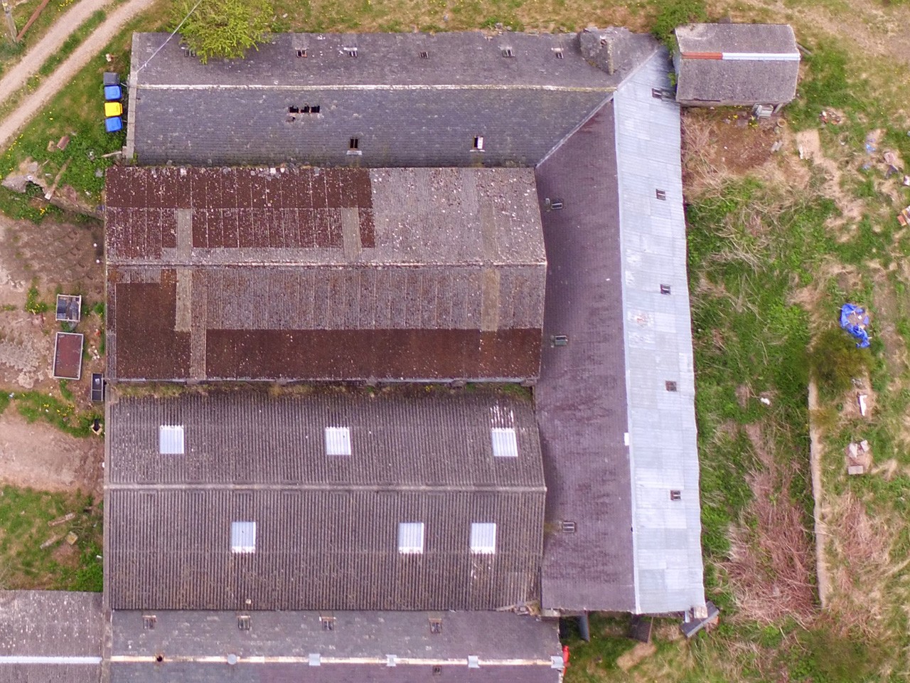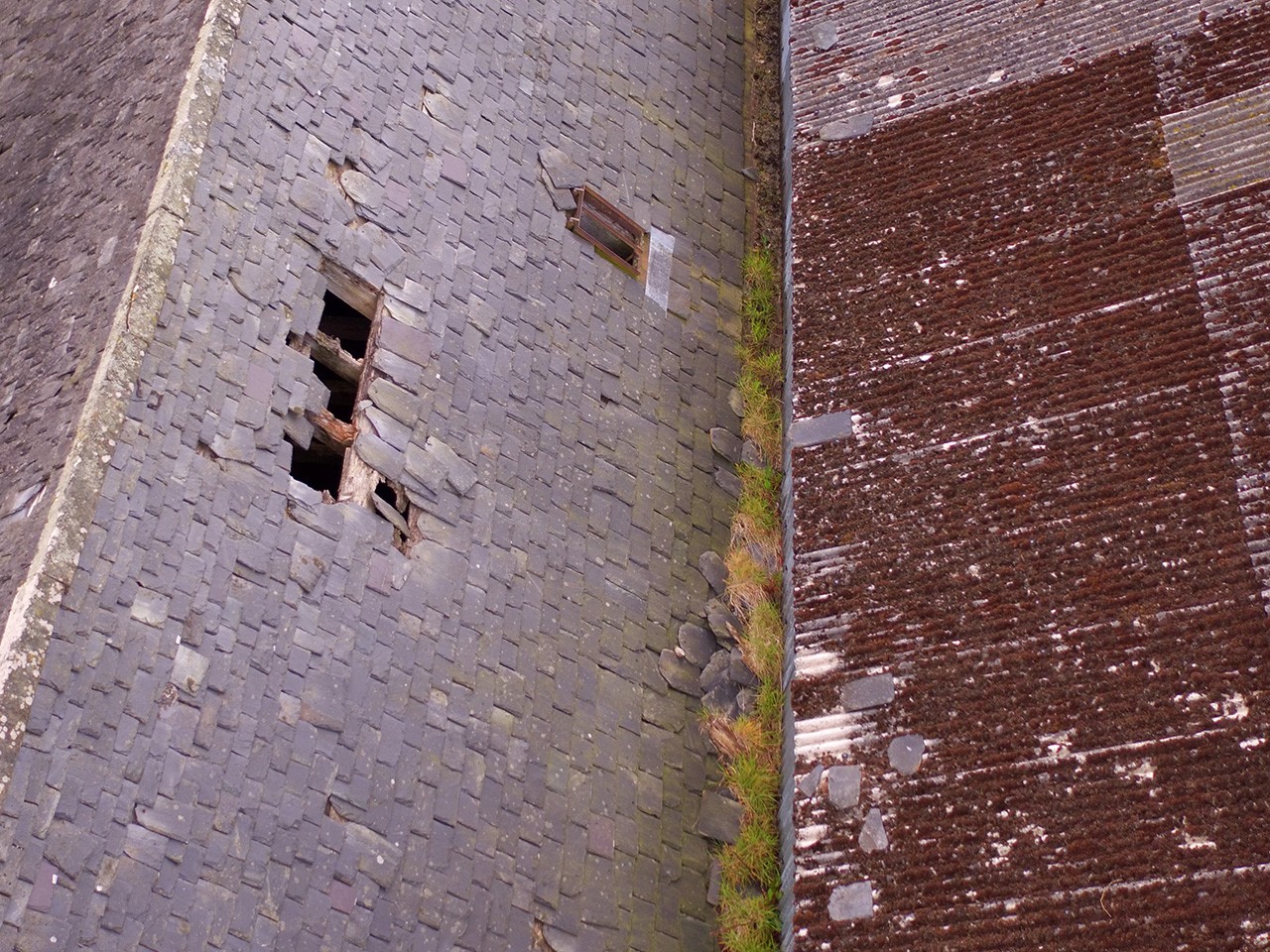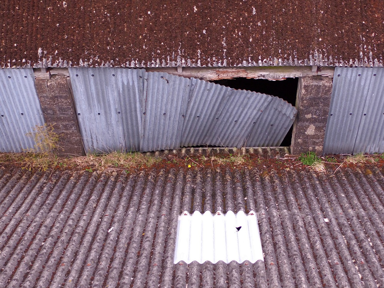
Insurance Applications
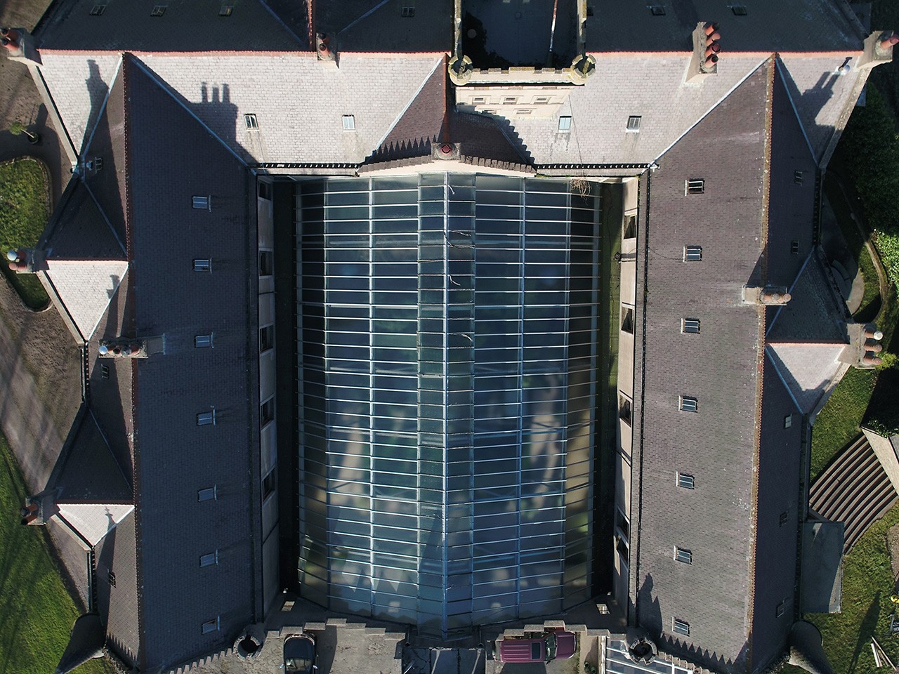
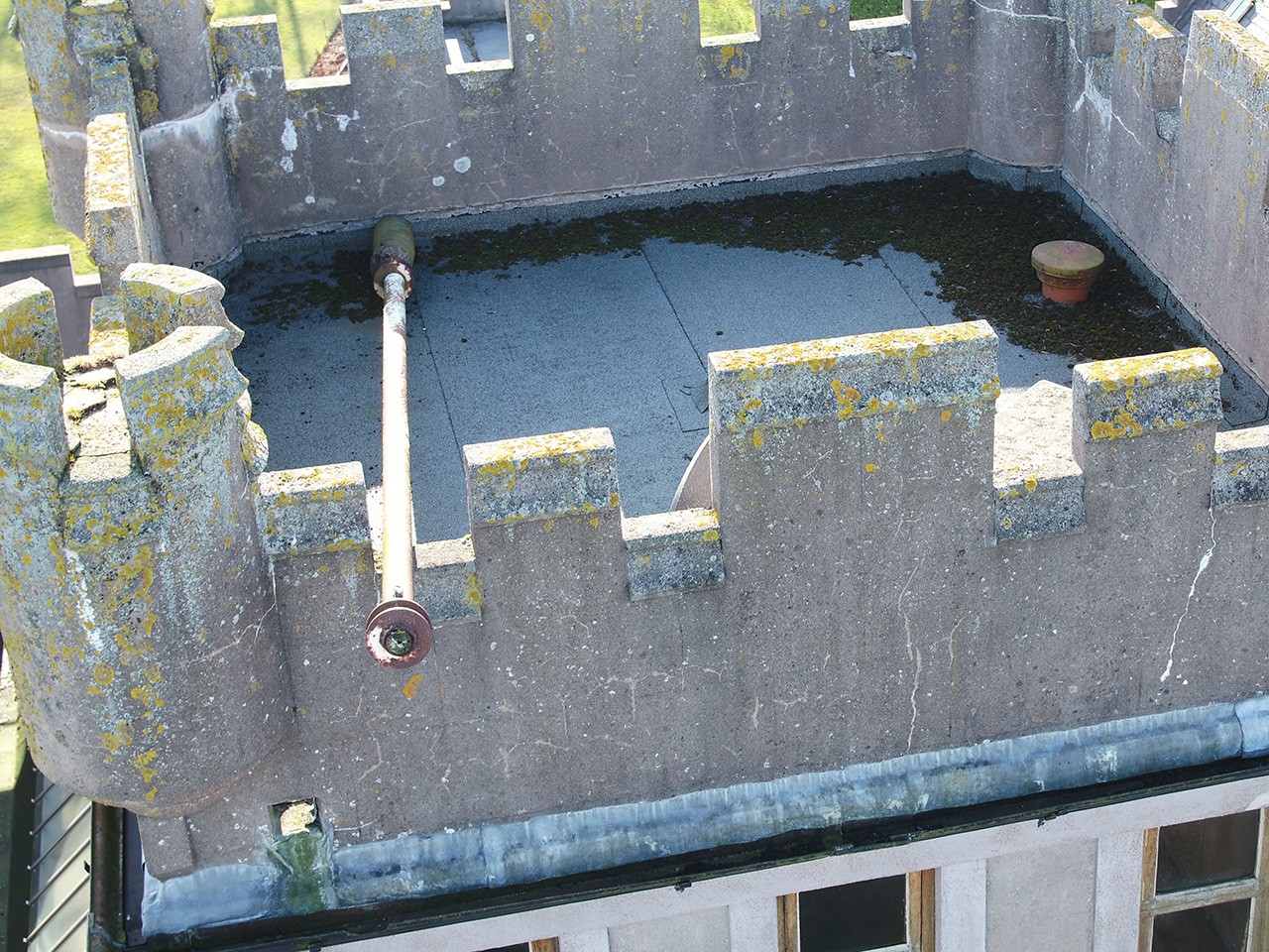

Using UAS's to capture high-resolution maps or images of a property after a natural disaster is a swift and cost-effective means of accurately quantifying and assessing the degree of loss. The benefits to Loss Adjusters in achieving this cannot be understated.
Whether photographing the roof of a building after a storm or mapping farm damage in the aftermath of a flood, UAS's provide exceptionally valuable sources of data to assess both the claim validity and value.